


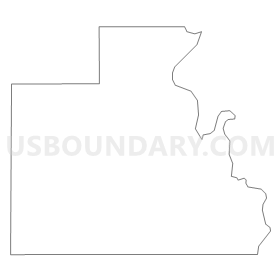
Voting District 0217010000002, Berrien County, Michigan
About
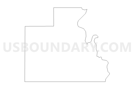
Outline
Summary
| Unique Area Identifier | 596024 |
| Name | Voting District 0217010000002 |
| County | Berrien County |
| State | Michigan |
| Area (square miles) | 13.39 |
| Land Area (square miles) | 13.21 |
| Water Area (square miles) | 0.18 |
| % of Land Area | 98.64 |
| % of Water Area | 1.36 |
| Latitude of the Internal Point | 42.00739770 |
| Longtitude of the Internal Point | -86.43031290 |
Maps

Graphs
Select a template below for downloading or customizing gragh for Voting District 0217010000002, Berrien County, Michigan


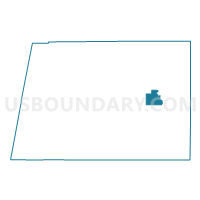
Neighbors
Neighoring Voting District (by Name) Neighboring Voting District on the Map
- Voting District 0210552000001, Berrien County, MI
- Voting District 0214760000002, Berrien County, MI
- Voting District 0216118000001, Berrien County, MI
- Voting District 0216118000003, Berrien County, MI
- Voting District 0217010000001, Berrien County, MI
- Voting District 0217444000001, Berrien County, MI
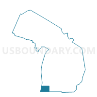
Top 10 Neighboring County Subdivision (by Population) Neighboring County Subdivision on the Map
- Lincoln charter township, Berrien County, MI (14,691)
- Oronoko charter township, Berrien County, MI (9,193)
- Royalton township, Berrien County, MI (4,766)
- Baroda township, Berrien County, MI (2,801)
- Sodus township, Berrien County, MI (1,932)
Top 10 Neighboring Elementary School District (by Population) Neighboring Elementary School District on the Map
Top 10 Neighboring Unified School District (by Population) Neighboring Unified School District on the Map
- St. Joseph Public Schools, MI (19,355)
- Lakeshore School District, MI (17,686)
- Berrien Springs Public Schools, MI (13,305)
- Eau Claire Public Schools, MI (3,535)
Top 10 Neighboring State Legislative District Lower Chamber (by Population) Neighboring State Legislative District Lower Chamber on the Map
Top 10 Neighboring State Legislative District Upper Chamber (by Population) Neighboring State Legislative District Upper Chamber on the Map
Top 10 Neighboring 111th Congressional District (by Population) Neighboring 111th Congressional District on the Map
Top 10 Neighboring Census Tract (by Population) Neighboring Census Tract on the Map
- Census Tract 18, Berrien County, MI (4,766)
- Census Tract 17, Berrien County, MI (4,649)
- Census Tract 214, Berrien County, MI (4,362)
- Census Tract 110, Berrien County, MI (2,801)
- Census Tract 19, Berrien County, MI (1,953)